The River Rea
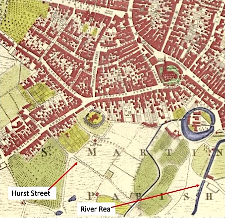
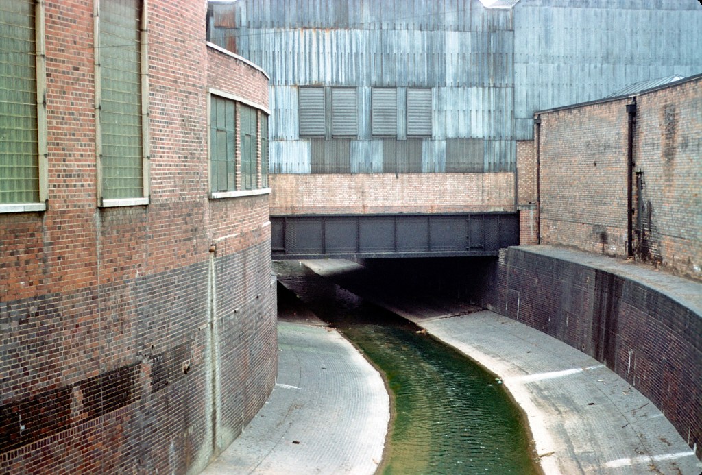
The passage which ultimately became Hurst Street is shown but not named in Samuel Bradford’s map of 1750, and it continues as a country lane which eventually leads to the River Rea. Today, as a result of urbanisation and re-routing, Bishop Street, Barford Street and Rea Street separate the end of Hurst Street and the river, which is now housed in deep culverts, and can only be viewed from the occasional road bridge.
Rea is one of the oldest place names in Birmingham. It is derived from the Middle English words “atter-e”, meaning “at the river”. The Rea has been called the Mother of Birmingham because it gave rise to the city as an industrial centre.
Until AD700 the site of modern Birmingham was largely ignored as an area to live. It was heavily forested with soil too poor to make it worth farming and the absence of major river valleys made communications difficult. There were more attractive places to settle for the small population of Britain. This altered in the seventh century when the mass arrival of Anglo Saxons from the continent meant an increased pressure for land. These new settlers migrated from the fertile coastal plains following river valleys into the heart of the country, where they built small villages in clearings in the forest (the suffix -ley is Anglo Saxon for clearing). In around circa AD750, a local chieftain named Beorma (or Birm) led a tiny group of followers (or ingas) northwards to build a new homestead (a ham), and thus “Birm- ingas-ham” came into existence. This small hamlet was built on the southern side of a sandstone ridge (the top of which is approximately where St Philips Cathedral now stands), which provided shelter from the northern winds, between the ridge and the River Rea, at a place near where that river could be forded.

Birmingham’s future was not to lie in soil and farming, but in business and within a couple of centuries Birmingham had expanded to become one of the biggest manors in Warwickshire, absorbing many of its richer neighbours. The ford through the River Rea at Digbeth provided a natural line of communication for cattle and trade goods moving through central England.
By 1166 Peter de Birmingham, who was a descendant of the Dudleys, applied to hold a cattle and food market every Thursday in the grounds of his “castle” and he was granted the right by King Henry II. The “castle” was the moated manor house which is remembered today by Moat Lane close to the Bull Ring.
The market was lucrative since tolls could be imposed on traders using the ford crossing the river and freedom from tolls given as a reward to people living in the area, which encouraged settlement in the town. By 1330 Birmingham was the third largest town in Warwickshire and still growing. In the Middle Ages, a diversion of the Rea was caused before Deritend Bridge was built in order to make two branches of the river. This was to allow the new course to power the village mill, this was later to power the Lloyds Slitting Mill in Digbeth. Although little more than a brook, the Rea could flood when rainfall was heavy and in 1778 an Act of Parliament was sought and passed to allow the widening and varying of the courses of the river by Deritend Bridge and also the making of a weir. These actions were to prevent the lower part of the town from being flooded.
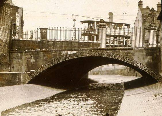
The source of the Rea is to the east of Gannow Green, between Romsley Hill and the Lickey Hills, the popular view that the Rea rises in Waseley Hills Country Park. From Rubery the river flows into Birmingham near the former Austin works at Longbridge, then through a tunnel under the A38. The river then flows through Northfield and Kings Norton continuing to Stirchley. It is now culverted for much of its course through Birmingham, during which it passes through Pebble Mill area and Cannon Hill Park then Calthorpe Park. Many of the street names in the Digbeth area refer to the river or its mills. These include Rea Street, Floodgate Street, River Street and Heath Mill Lane. Now fully culverted the river flows parallel to Rea Street, through Digbeth next to Floodgate Street, and on through Saltley and Nechells. Near to Spaghetti Junction (Gravelly Hill Interchange), approximately fourteen miles (23 Kilometres) from its source, the Rea merges with the River Tame, with its waters eventually reaching the North Sea via the Trent and the Humber Estuary.
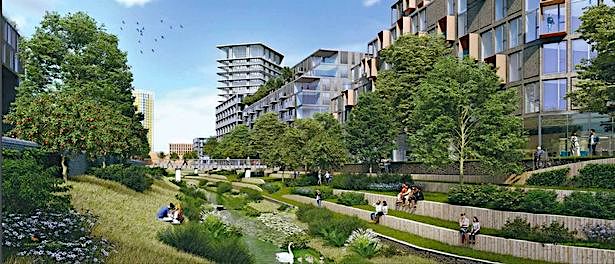
Birmingham City Council has launched a public consultation on plans to transform 73 hectares (180 acres) south of Birmingham City Centre known as the Rea Valley Urban Quarter. Accommodating over 5,000 new homes it will provide affordable and private housing, attracting families to the city centre supported by a range of community facilities and employment space. Expanding out from the Smithfield development the area will focus on a reimagined River Rea as a green corridor that enhances its water management role and delivers significant social benefits.
So, it’s back now to our walk and the ex-White Swan at the junction of Hurst Street and Sherlock Street.