Hurst Street – History
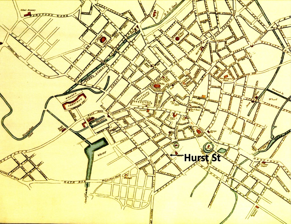
Hurst Street takes its name from the Old English word “hyrst”, meaning wooded hill, and when the road first appeared at the end of the eighteenth cen- tury it was known as Hurst Hill. At that time it was just a passage way which went through an arch at the side of the White Swan pub in Smallbrook Street. Down this entry was a knackers yard, a shop for dye- ing of felt hats and a few cottages. By contrast Smallbrook Street itself was well established and was obvious on Westley’s map of 1731 as an extension of the even older Edgbaston Street.
The passage which became Hurst Street is shown but not named in Bradford’s map of 1750. By the time of Hanson’s map of 1778, the nearby Thorp Street has been cut, but gardens dominated the area between the future Hurst Street and the back of Edgbaston Street and Jamaica Row.
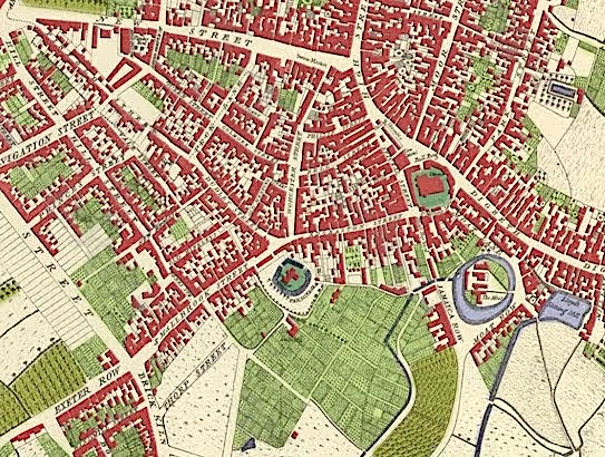
Ten years later, an advertisement offered a building lease for “a spot of land” on Hurst Hill. In Pye’s map of 1795 (below), not only is Hurst Street shown but also Inge Street, named after the family of that name from Thorpe Constantine in Staffordshire. Hurst Street came from an Act of Parliament in 1753 which empowered Theodore William Inge to make building leases on part of his land.
The district to the east of Hurst Street was owned by the Gooch family and was not cut through by Pershore Street and its offshoots until the late 1820’s when Sherlock Street also emerged. The cutting of this new street, also led to the filling in of the land between itself and Bromsgrove Street. Despite the building of back to back houses and workshops, a village feel continued to pervade in the Hurst street neighbourhood into the 1820’s.
In 1796 John Snape surveyed the whole of Sir Thomas Gooch ‘s estate, and produced a series of hand drawn maps of his holdings. All of the plots on Hurst Street were leased between 1789 and 1792. Those on Inge Street were leased between 1789 and 1822