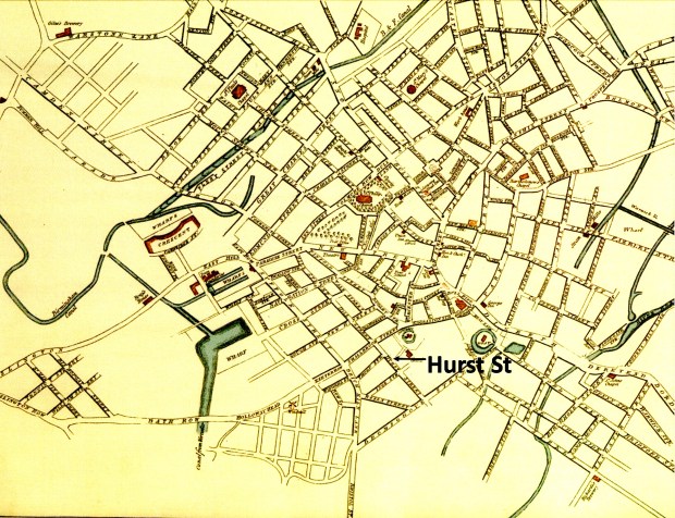
Hurst Street – A Walk Through History
If you could step back in time and searched for Hurst Street you would be hard pressed to find any sign of our subject much before the middle of the 18th century. One of the local landowners was Richard Smalbroke, and a street heading from the town of Birmingham, towards Edgbaston, along the southern edge of his land carried his name. The Smalbrokes had land in Yardley and the family home still stands – Blakesley Hall. The Smalbrokes married into the Vyse family – another name with historical significance in the growing town of Birmingham.

Up until the 1960s the aforementioned street was Smallbrook Street, which vanished under the city’s concrete collar to become Smallbrook Queensway.
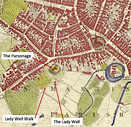
But, let’s step back to 1553 and take a look at a map created in that year. It shows the area to the south of the town and St Martin’s Church clearly dominates the area. Just to the south is the de Bermingham’s Manor House with its moat, we can see the location of the Rectory (or Parsonage) to the west and to the south is another significant landmark – Lady Well. We can also see the “Land of Richard Smalbroke” and the probable future line of Hurst Street.
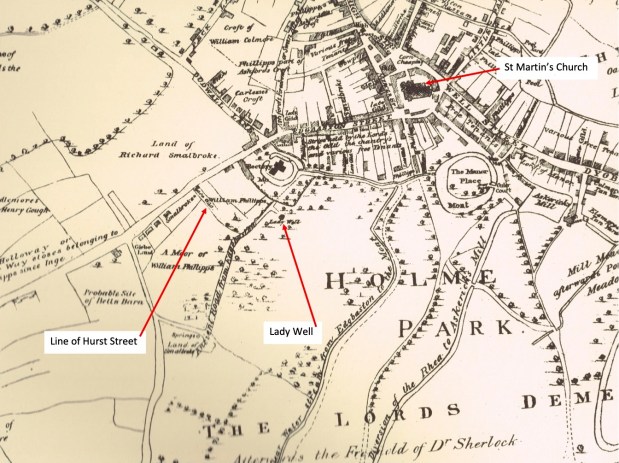
At the foot of the map is a name of another significant landowner – Dr Sherlock, – this time with another story to tell, but centuries later.
But if you look at a maps from 1731 and 1750, you will see an unnamed lane heading south-east from Smalbroke (or Smallbrook) Street which would later become Hurst Street. It was known that at the time this area was farmland and orchards but by the end of the century change was afoot.
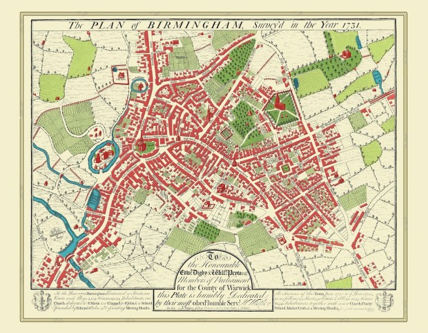
Hurst Street takes its name from the Old English word “hyrst”, meaning wooded hill, and when the road first appeared at the end of the eighteenth century it was known as Hurst Hill. At that time it was just a passage way which went through an arch at the side of the White Swan pub in Smallbrook Street. Down this entry was a knackers yard, a shop for dyeing of felt hats and a few cottages. By contrast Smallbrook Street itself was well established and was obvious on Westley’s map of 1731 as an extension of the even older Edgbaston Street.
The passage which became Hurst Street is shown but not named in Bradford’s map of 1750. By the time of Hanson’s map of 1778, the nearby Thorp Street has been cut, but gardens dominated the area between the future Hurst Street and the back of Edgbaston Street and Jamaica Row.
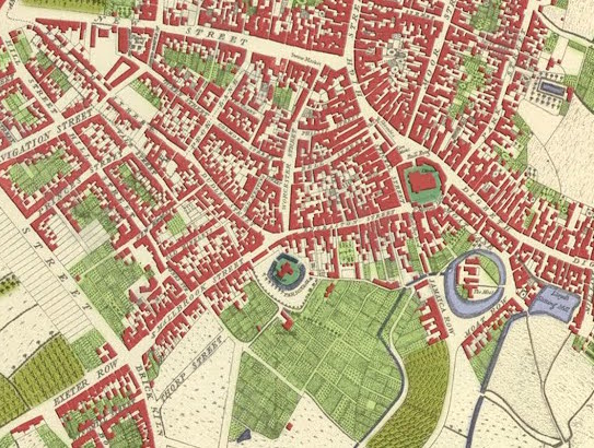
Ten years later, an advertisement offered a building lease for “a spot of land” on Hurst Hill. In Pye’s map of 1795 (below), not only is Hurst Street shown but also Inge Street, named after the family of that name from Thorpe Constantine in Staffordshire. Hurst Street came from an Act of Parliament in 1753 which empowered Theodore William Inge to make building leases on part of his land.
The district to the east of Hurst Street was owned by the Gooch family and was not cut through by Pershore Street and its offshoots until the late 1820’s when Sherlock Street also emerged. The cutting of this new street, also led to the filling in of the land between itself and Bromsgrove Street. Despite the building of back to back houses and workshops, a village feel continued to pervade in the Hurst street neighbourhood into the 1820’s.
In 1796 John Snape surveyed the whole of Sir Thomas Gooch ‘s estate, and produced a series of hand drawn maps of his holdings. All of the plots on Hurst Street were leased between 1789 and 1792. Those on Inge Street were leased between 1789 and 1822

Click on the link below to take you to The Route of the Walk